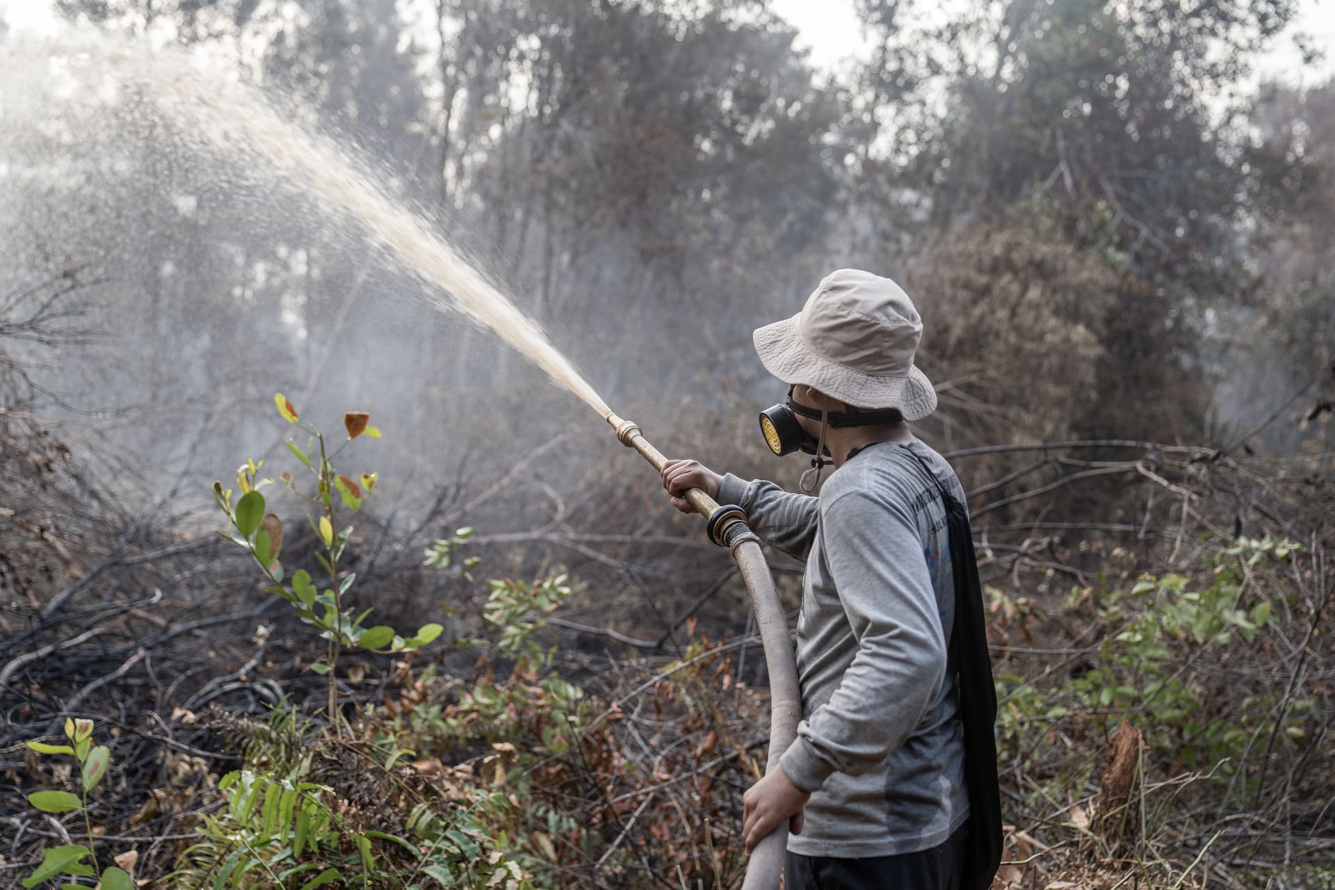


With the current El Niño weather system escalating, Central Kalimantan is experiencing severe fire conditions in 2026. At the Katingan Mentaya Project, teams have been monitoring the changes since the start of the year, forecasting impacts since March and responding to fires beyond the project boundary since early August. Although conditions on the ground remain challenging, more than a decade of investment in peatland rewetting, early detection and locally based firefighting capacity is effectively helping to protect the forest.
In this article, we assess the risks posed by forest fires to people, biodiversity and carbon in Central Kalimantan, outline the latest developments in the field, highlight the infrastructure being used to mitigate the dangers and reveal the wider strategy informing our response.
The current situation (September 2026)
Forest and land fires have intensified across Indonesia during the current dry season. By 20 August, the Ministry of Forestry’s SiPongi monitoring portal had recorded around 202,000 hectares burned nationally – more than double the equivalent figure for 2023. Other independent satellite analyses have produced substantially higher estimates.
Central Kalimantan has been particularly hard hit. As we approach the peak of the dry season, hotspot detections have increased, while smoke and haze have reduced visibility and affected air quality in Palangka Raya and elsewhere. The situation remains active: Katingan Regency authorities continue to strengthen fire control coordination in September as the drought continues.
A major factor is the ‘Super El Niño’, which is amplifying the annual dry season. This is particularly relevant to peatland landscapes. Healthy peat is waterlogged and naturally resistant to fire; when it dries, however, it can ignite and burn underground, making fires difficult to locate and extinguish. For the Katingan Mentaya Project, these conditions have required a concerted response on many fronts.
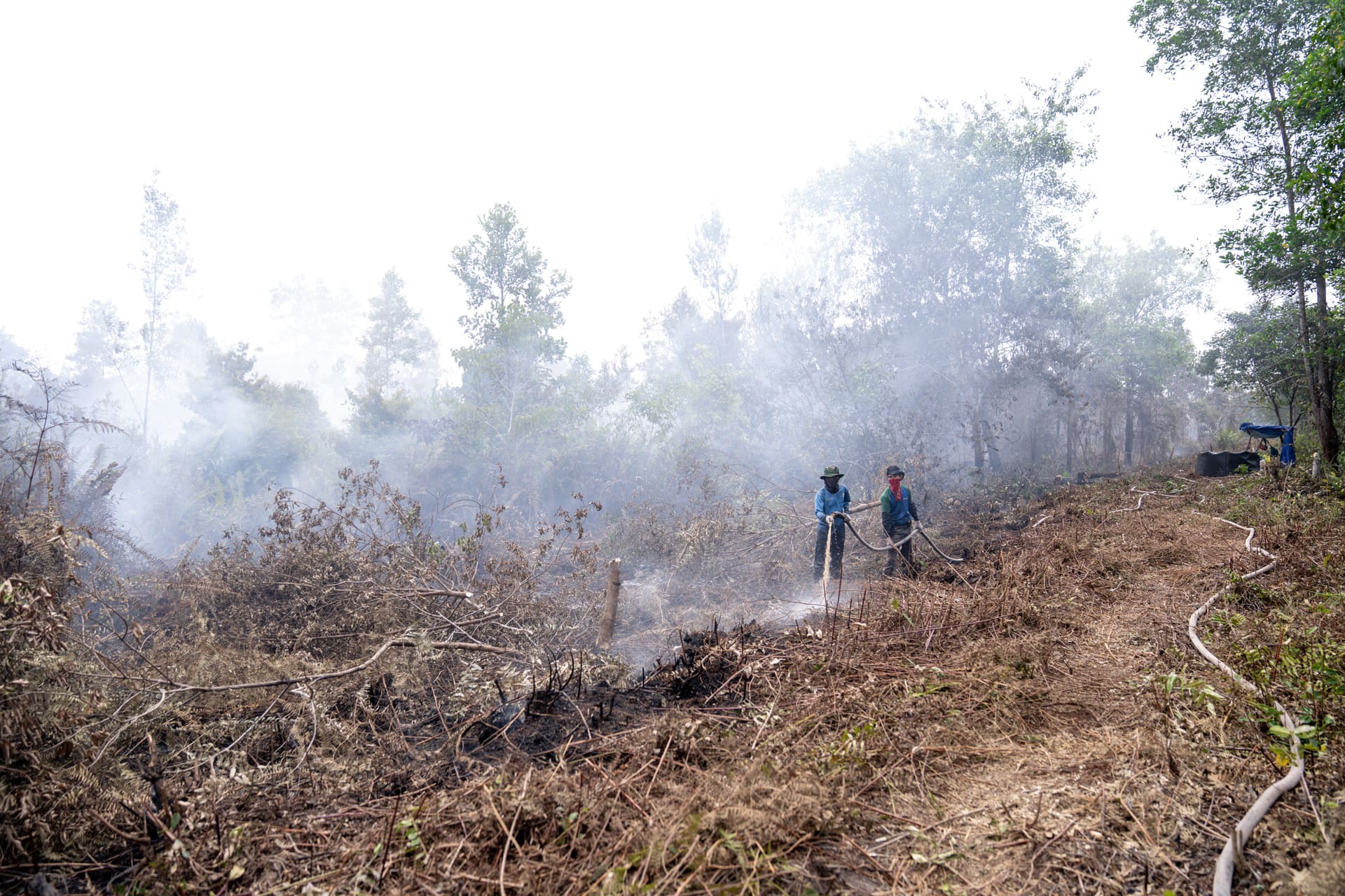
Project management raised its internal status to Fire Emergency Response on 7 August, following confirmation of a fire on community land outside the project near Batuah Village. Throughout August, teams also fought fires at nine locations around the canal systems of Pulau Hanaut and across Batuah and Terantang Hilir in Seranau District. All were situated outside the project, although at some points the fire front advanced to within 50 metres of project boundaries.
On 2 September, an indication of fires was recorded at the south-western project boundary. Teams responded with intensive peat wetting, firebreaks and direct suppression. The extent of these fires is currently being assessed. Any subsequent impacts confirmed within the project area will be reported to the Government of Indonesia and Verra in accordance with regulatory and certification requirements.
Prevention is better than cure: infrastructure in action
The project protects nearly 150,000 hectares of globally significant tropical peatland and is projected to prevent approximately 430 million tonnes of CO₂-equivalent emissions over its lifetime. This makes long-term protection of peatlands vitally important. Our ongoing response is supported by extensive fire prevention and emergency response infrastructure that has been developed over more than a decade.
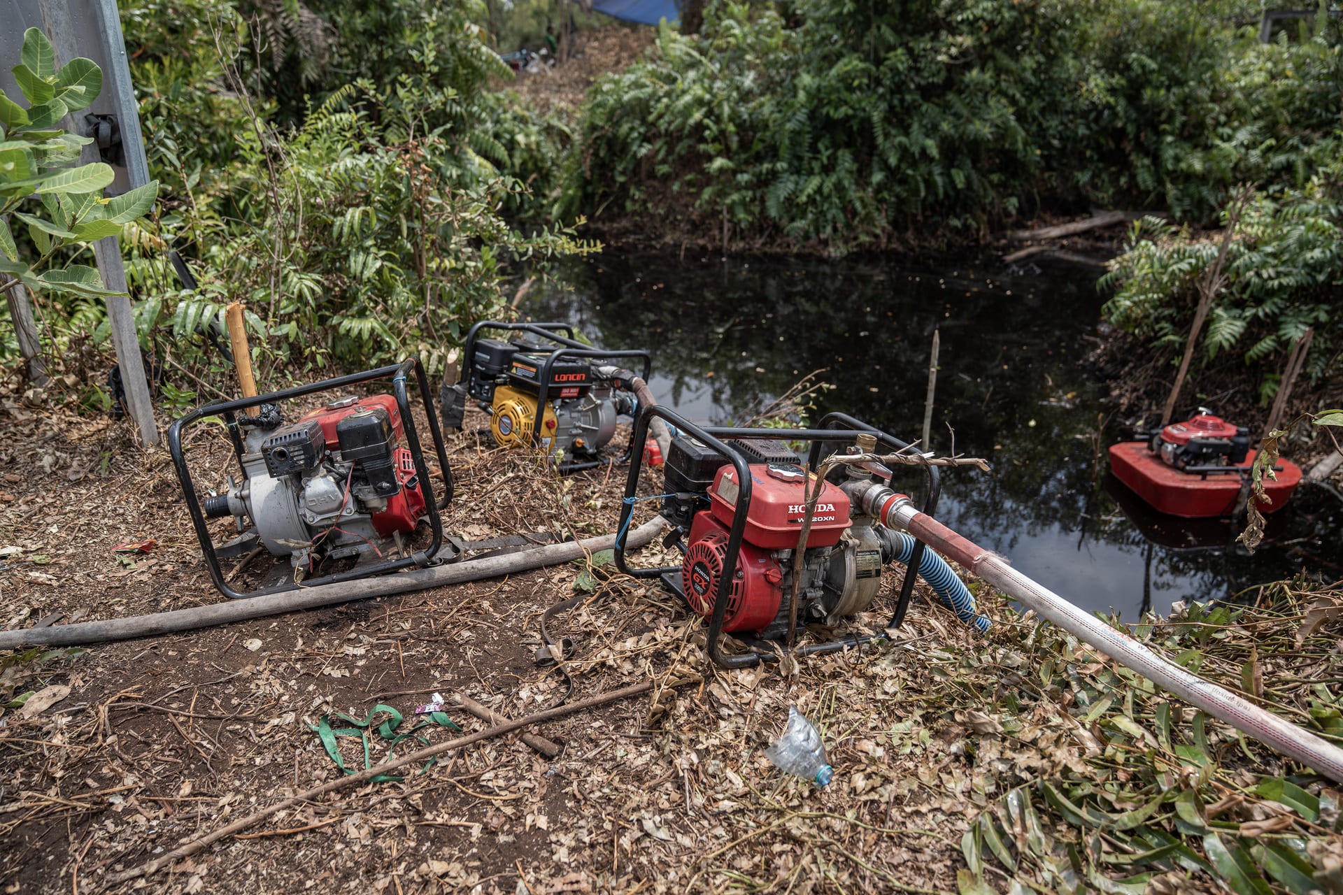
The first line of defence is water. Maintaining high water levels is fundamental to reducing fire risk in peatland forests. The project has built 112 canal blocks and dams to retain water in the peat, together with 559 fire bore wells and 198 reservoirs and dug wells, which provide readily accessible water sources for firefighting teams. The project also maintains 6,760 metres of green firebreaks, using high-moisture vegetation to slow the spread of fire, alongside cleared firebreaks at vulnerable sections of the boundary and neighbouring community-managed land.
Fire Prevention Infrastructure | |
| 112 canal blocks and dams | 18–22 daily patrols |
| 559 fire bore wells | 10 watchtowers |
| 198 reservoirs and dug wells | 23 guard posts |
| 6,760 metres of green firebreaks | 546 community firefighters trained |
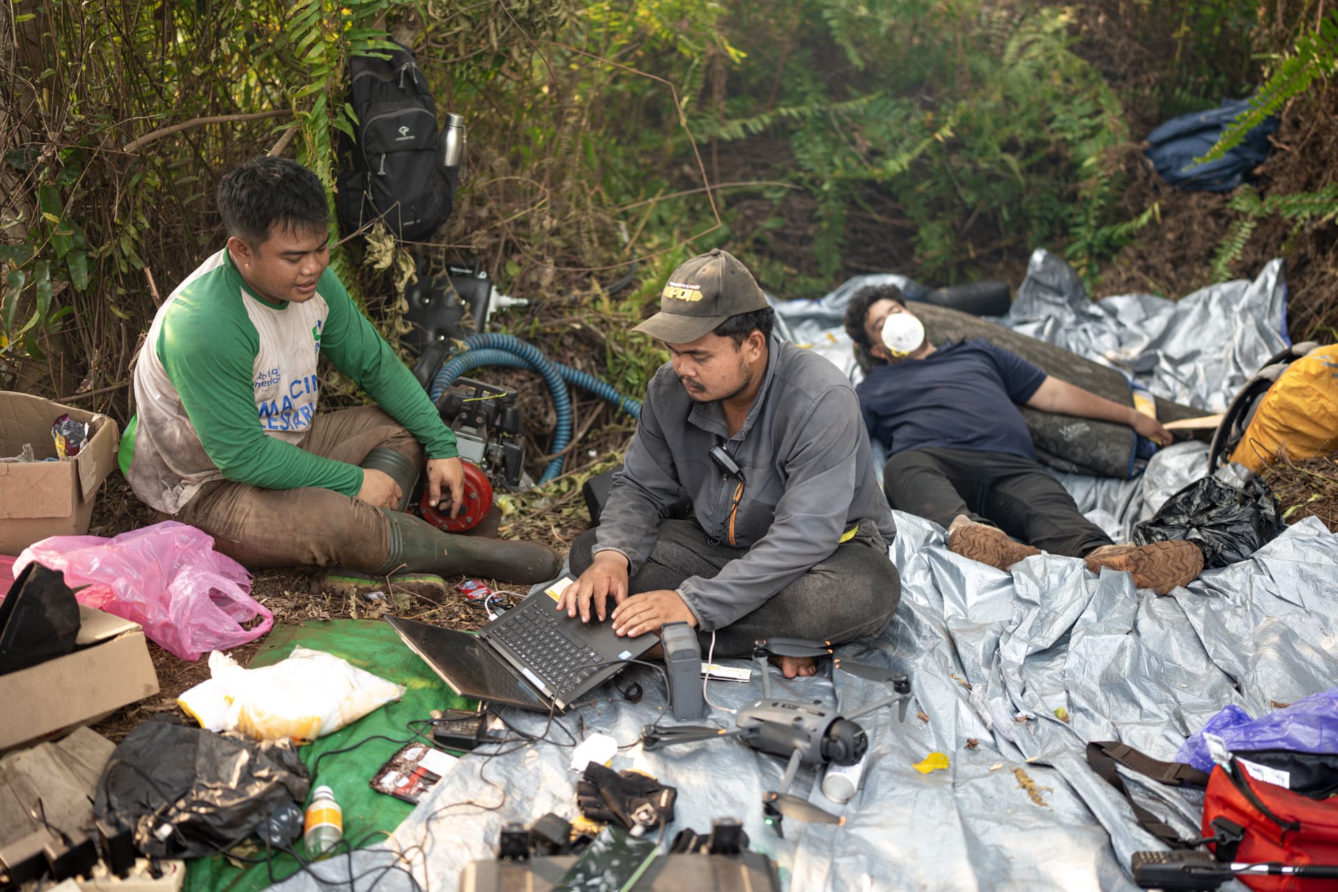
The second line of defence is early detection. During the dry season, Katingan Mentaya Project field teams conduct 18–22 patrols every day by motorcycle, boat and drone. Ten watchtowers, a real-time CCTV tower and 23 guard posts and basecamps provide additional coverage.
Ground-level monitoring is combined with a landscape-level view of the situation, via satellite hotspot feeds from Indonesia’s SiPongi system, NASA FIRMS, BRIN and OroraTech. These data are cross-checked against the project’s own peat water-table measurements and fire danger assessments, which help our field teams to identify potential fires quickly and direct people and equipment where they are needed most.
The 2026 season has also required that system to evolve and expand in real time. During the second half of August, the Pulau Hanaut zone added 16 canal blocks, 69 reservoirs, 16 dug wells and seven new posts and shelters, as well as new land and water access routes. Crews also established a 1.4-kilometre firebreak along Secondary Canal 6 at Batuah.
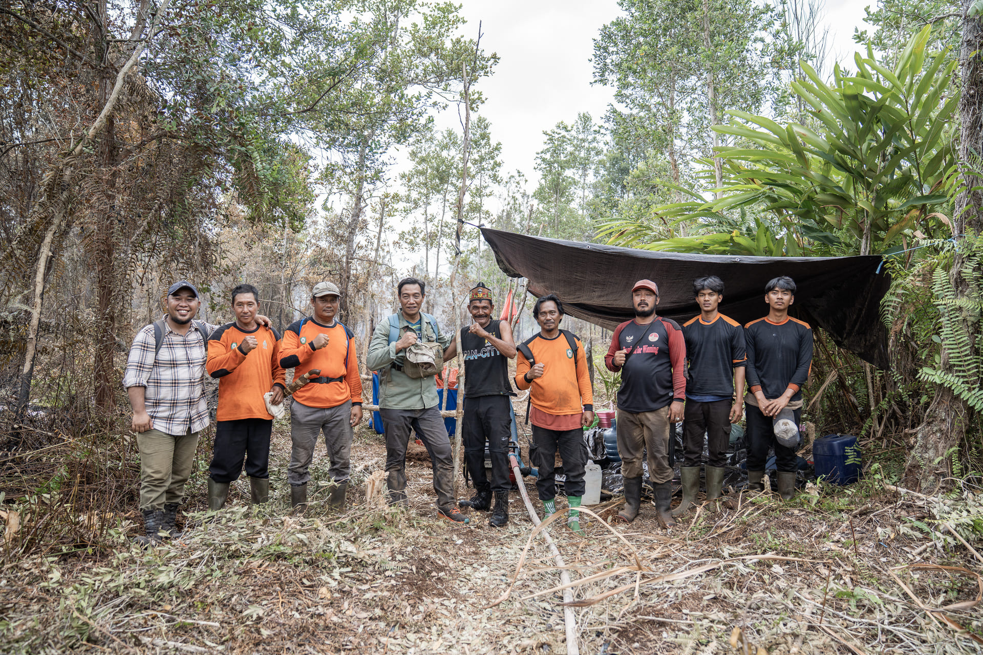
At the end of August, 171 people were deployed across the two of the most exposed zones, supported by 251 pump engines, more than 25 kilometres of hoses and 19 drones. Behind them are five permanent Fire Control Brigade teams comprising 77 people and 35 village-based fire teams. In total, 546 community members have been trained as firefighting teams.
This combination of permanent infrastructure, technology and local capacity is particularly important, because fires do not respect project boundaries. When fires occur, RMU teams work closely with village communities, district fire task forces, forest management units, the disaster agency, police and neighbouring landowners to achieve a concerted response on multiple fronts.
Impacts on people and biodiversity
With fires continuing to burn, the immediate concern is the health and safety of people living in and around affected areas. Peat fires can generate particularly high levels of particulate pollution, and haze from the wider 2026 fires has already affected communities across Kalimantan. The impacts extend well beyond the location of individual fires, making prevention and rapid suppression important public health measures as well as forest-management activities.
The threat to biodiversity is also a major concern. The Katingan Mentaya Project protects one of the larger remaining contiguous areas of peat swamp forest in Central Kalimantan, home to an estimated 1,881–3,768 Critically Endangered Bornean orangutans (Pongo pygmaeus). Five other Critically Endangered and 15 Endangered species have also been recorded within the project area.
Preventing fires from entering the forest therefore not only protects the carbon stored within its peat and vegetation; it also preserves the habitats of endangered species and mitigates the risk of escalating health impacts in local communities. On all three fronts, a combination of long-term preparation and immediate response is critical to success.
What does this mean for carbon credit buyers?
Fire is a known risk for any long-term forest protection project. The Verified Carbon Standard (VCS) therefore incorporates mechanisms specifically designed to account for potential losses. Credits that have already been issued, sold or retired are not invalidated by a subsequent fire. If a fire causes a measurable carbon loss within the project, the loss is quantified and incorporated into subsequent carbon accounting and future issuance.
The VCS also requires land-based projects to contribute credits to a pooled buffer account covering non-permanence risks, including fire. The Katingan Mentaya Project’s current contribution rate is 14%, and the project has contributed more than seven million credits to the buffer over its lifetime. These accounting safeguards are important, but risk management starts much earlier. Carbon finance supports the canal blocks, bore wells, monitoring technology, patrols, trained crews and village fire teams that work to prevent a reversal occurring in the first place.
Lessons learned (and applied) since 2015
Infrastructure being used today integrates knowledge accumulated through previous fire seasons, while data from each of the previous three El Niño seasons provide a clear barometer of how this knowledge is being utilised to reduce the likelihood of fires in project areas. In 2015, 10,530 hectares burned within the project area, with satellite and hotspot analyses finding that the fires originated outside the project boundary. When El Niño returned in 2019, the area affected inside the project dropped to 1,921 hectares. In 2023, another El Niño year, no high-confidence hotspots were recorded inside the project area.
This demonstrates the value of long-term planning and the efficacy of a coordinated, adaptive and multi-faceted response. Essentially, each historical event up to this point has informed subsequent planning: more water infrastructure, stronger local firefighting capacity, improved risk mapping and substantially more sophisticated remote sensing and early-warning technology. We are now seeing the benefits of this infrastructure in action.
The 2026 season is clearly the most demanding test of that system. Conditions remain serious, and our priority continues to be the protection of people, wildlife and the forest until sustained rainfall returns to Central Kalimantan. At the same time, the response so far clearly illustrates the practical value of preparing for fire before it happens. Infrastructure built over years is providing water where crews need it most; monitoring systems are identifying threats earlier; local teams are mobilising rapidly, according to pre-existing action plans; and additional infrastructure is being deployed as conditions change.
For a long-term peatland protection initiative like the Katingan Mentaya Project, fire preparedness is not an emergency measure activated once threats materialise; rather, it is a central pillar of project infrastructure which is designed ahead of time and structured to function as needed. While the situation continues to escalate in the field, our response will also evolve to meet these challenges. From landscape-level monitoring to ground-level implementation, the Katingan Mentaya Project will continue to leverage a decade of experience and planning to mitigate the risks posed to people, forest and biodiversity in the weeks and months ahead.
About the Katingan Mentaya Project
The Katingan Mentaya Project is a tropical peatland forest protection and restoration project in Central Kalimantan, Indonesia, operating since 2010 across the Mendawai, Kamipang, Seranau and Pulau Hanaut sub-districts. Covering a combined area of 157,875 hectares, the project is operated by PT Rimba Makmur Utama (RMU) under a 60-year Ecosystem Restoration Concession (IUPHHK-RE), during which time it is forecast to prevent more than 400 million tonnes of CO₂-equivalent emissions. Following the reopening of Indonesia’s international voluntary carbon market on 6 July 2026, the project had 20 million credits verified by the standard body Verra.
Frequently Asked Questions
Are there currently fires inside the Katingan Mentaya Project?
Not at the time of writing (September 2026). Through August, the fires tackled by project teams were located outside the project boundaries. On 2 September, an indication of fire was recorded at the south-western boundary. Teams responded with peat wetting, firebreaks and direct suppression. Any subsequent impact confirmed within the project area will be formally assessed and reported.
Why are peat fires particularly difficult to control?
Healthy peat is waterlogged. Once sufficiently dry, however, peat can burn below the surface and continue smouldering underground. This is why maintaining peat water levels is central to the project's fire prevention strategy.
What happens to carbon credits if a fire damages the project?
Previously issued, sold or retired credits are not invalidated - they continue to represent avoided emissions for the year they were verified. Any carbon loss is accounted for against future project performance, while the VCS pooled buffer mechanism provides additional protection against reversal risk.
How many people are involved in the response?
At the end of August, 171 people were deployed across the two most exposed zones. The project's standing capability includes five core Fire Control Brigade teams and 35 village-based fire teams, with 546 community members trained for firefighting.
Buy carbon credits from Katingan
Climate change is a global challenge that requires global action. We can help you meet your commitments to deliver a brighter future.